01249 715566
hello@polarocean.co.uk
Facebook
Twitter
YouTube
Instagram
RSS
  • About
    • Objectives
    • Crew
    • Boat photos & specs
    • Education
  • Expedition Log
    • Photos & Footage
    • Ships Logs
    • Crew (B)logs
    • Sea State logs
  • Tracking Boat
    • Tracking
    • Sea Ice Charts
    • The Route
  • Contact Us
  • Sea Ice News
  • Media Coverage

SEA ICE COVERAGE UPDATES

These below are derived from satellite images showing the recession of the Arctic sea ice over the Arctic summer. They are updated here every week

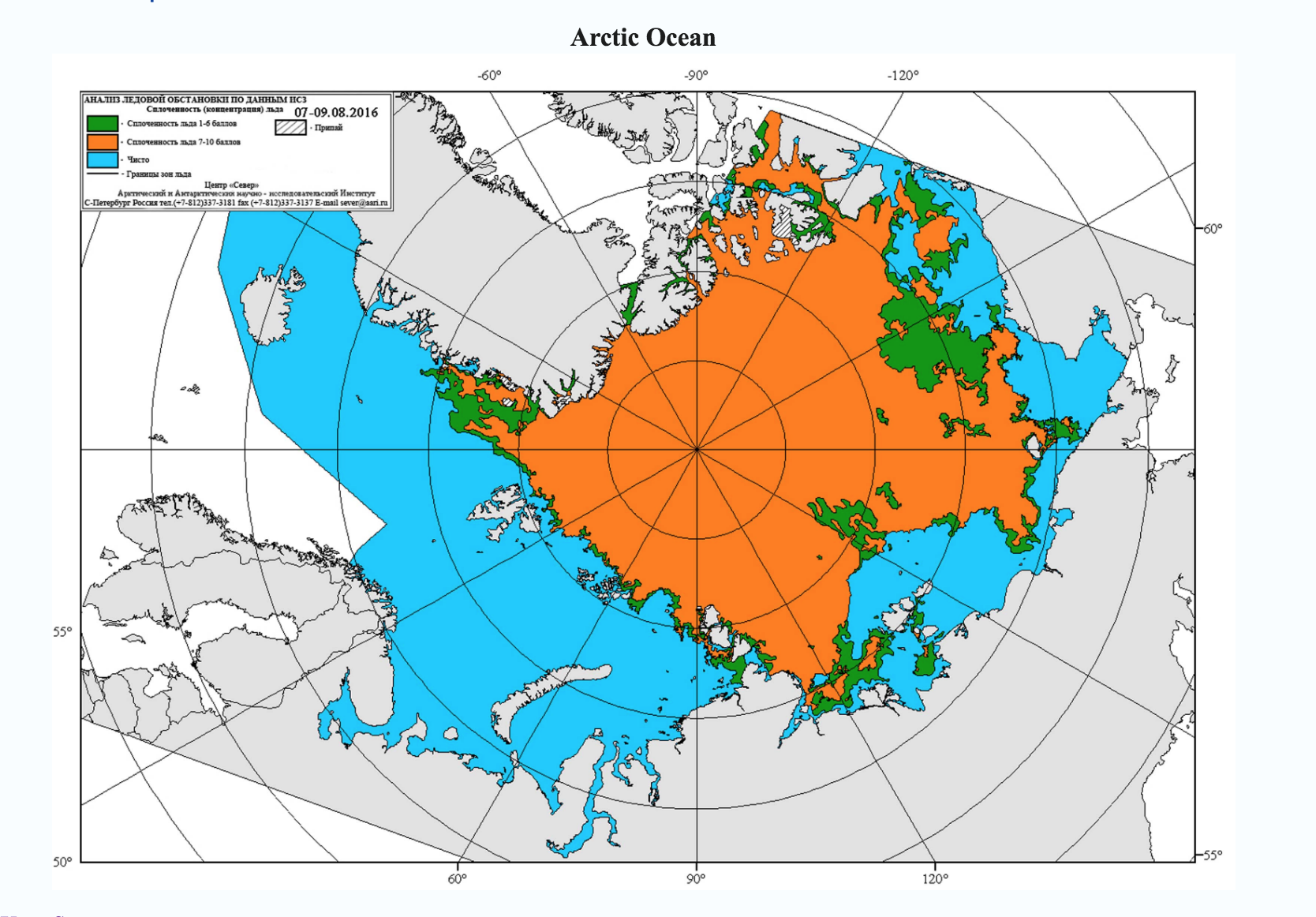
RUSSIAN ICE EXTENT CHARTS

Charts courtesy of The Northern Sea Route Administration of Russia Click on image to see detail

Laptev Sea 9 Aug

Laptev Sea 9 Aug

CANADIAN ICE EXTENT CHARTS

Images courtesy of The Canadian Government ice service     Click on image to see detail

WHOLE ARCTIC

THIS WEEK
Previous weeks
THIS WEEK

False colour modus composite satellite image from above the North Pole.

The blue areas are the sea ice extent.

Previous weeks

WESTERN ARCTIC

THIS WEEK
Previous weeks
THIS WEEK

Regional ice analysis from the Western Arctic

Click on image to see detail

Previous weeks

EASTERN ARCTIC

THIS WEEK
Previous weeks
THIS WEEK

Regional ice analysis from the Eastern Arctic

Click on image to see detail

Previous weeks

© 2016 Polar Ocean Challenge | Cookie & Privacy Policy | Website Disclaimer | Web Design by Joe Dowdell & Frances Gard
This site uses cookies: Find out more.